


By Clara Margotin (PA)
The Met Office has announced the next named storm as Chandra, which is forecast to bring strong winds, heavy rain and snow across much of the UK on Monday night and Tuesday.
Forecasters say flooding and travel disruption are likely in some places and there will also be significant snow across higher ground in some northern parts of England and some of Scotland.
Several weather warnings have been issued, including amber warnings for south-west England and the eastern coast of Northern Ireland for rain and wind respectively.
The Met Office said gusts of 60-70mph will affect eastern Northern Ireland, with possible 75mph gusts in coastal locations, adding that “easterly winds of this strength are unusual and are likely to be impactful”.
Across the south west of England, where Storm Ingrid wreaked havoc and washed away part of a historic pier on the weekend, forecasters expect more downpour.
An amber warning for rain is in place for south Devon, much of Dorset, southern Somerset and south-east Cornwall, where 30-50mm of rain could fall widely with up to 60-80mm over higher ground of south Dartmoor.
Less severe yellow warnings are in place for all of Northern Ireland and a more extensive area of south-west England, as well as parts of northern England and Scotland.
A yellow warning for wind covers Cornwall, southwestern Wales and parts of northern Devon, while yellow warnings for snow have been issued for Scotland and northern England where 2-5cm could fall widely and as much as 10-20cm could accumulate at higher elevations.
An update from the Environment Agency shows 21 flood warnings and 124 flood alerts were in place across England as of 1pm on Monday.
Flood warnings have been issued across the South West mostly, and two are in place around York.
Met Office chief forecaster Paul Gundersen said: “Initially, strong winds will impact the Isles of Scilly, western Cornwall and south-west Wales which are still vulnerable after Storm Goretti, gusts of 70 to 80mph are possible here.
“Heavy rain is an additional hazard as it falls on saturated ground in Dorset and southern parts of Devon, Somerset and Cornwall.
“As Chandra interacts with colder air further north snow becomes a hazard, with 10-20cm of snow possibly accumulating over higher ground in the Pennines, southern Scotland and the Highlands.
“With a complex spell of weather, its important people stay up to date with the forecast and any warnings in your area.”
RAC mobile servicing and repairs team leader Nick Mullender said: “Flooding is highly likely, making many roads dangerous. Our message to drivers is simple: do not drive through standing water unless you are completely certain the water is shallow enough and it’s safe to do so.
“In these conditions, drivers need to slow down and stay alert. Wet roads can double stopping distances, so taking a cautious, steady approach and allowing extra time to react is essential.
“And if your vehicle already has known faults, now is not the time to take risks. Avoid unnecessary journeys and get issues fixed promptly by a trusted mobile mechanic or local garage.”
Storm Chandra is the next storm to be named by the western Europe storm naming group list shared between the UK, Ireland and Netherlands.
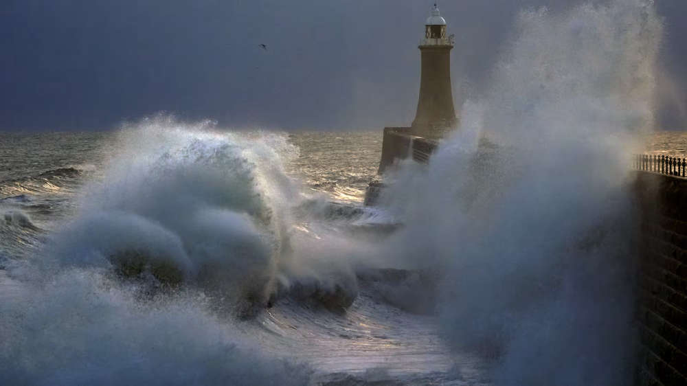
Storms are named when they are expected to cause medium or high impacts (Owen Humphreys/PA)
 High Court told Gerry Adams ‘major, major player in war!'
 Natalie McNally murder accused ‘lied and lied again’
 Woman dies in two-vehicle collision in Enniskillen
 Little-Pengelly leads mission to showcase NI in Washington on St Patrick’s Day
 Psychiatrists warn of ‘workforce crisis’ facing NI mental health services