


By Dominic McGrath, PA
The island of Ireland is facing high winds and heavy rain, as both sides of the border brace for the impact of two storms.
Storm Dudley and Storm Eunice are expected to cause significant disruption across the island over the coming days, with flooding possible in some areas.
In Northern Ireland, the Met Office issued an amber wind warning for Co Antrim and Co Derry/Londonderry, with yellow warnings in place for the rest of the northern counties.
On Wednesday morning, gusts of 63mph were recorded at Orlock Head near Bangor in Co Down.
A driver escaped injury after a tree struck his car on Lislaban Road, in Cloughmills, Co Antrim.
The Department of Agriculture, Environment and Rural Affairs advised people not to visit country parks and people are also being warned of large waves in coastal areas.
A wind warning was in place for the Republic, with gusts expected to reach 110km per hour.
Storm Dudley was due to clear away overnight, after a day of heavy rain and strong winds, according to Met Éireann.
In Britain it is northern England and Scotland which are expected to be among the worst affected.
It is anticipated that Storm Eunice will hit Ireland and Britain tomorrow night, bringing further wind, snow and the possibility of snow.
Met Éireann meteorologist Matthew Martin said: “We’re keeping a very close eye on the forecast for Friday as Storm Eunice is expected to bring some challenging weather conditions, especially on Friday morning as strong winds, heavy rain and snow moves across the country.
“At the moment it looks like northern and western areas are most likely to see the heaviest snowfalls, with southern areas expected to see the strongest winds, however we’re still a few days ahead and the details of when and where are likely to change.
“With this in mind, we’re urging people to keep a very close eye on the forecast and warnings for their area as these may change in the coming days.”
Police in the Republic have already warned people to exercise caution, amid concerns about flooding in some areas.
Poor conditions will return again on Friday, as Storm Eunice brings with it more threats of flooding.
A Status Yellow wind, rain and snow warning will take effect in the Republic from 1am on Friday and will last until 3pm.
This afternoon, Met Éireann upgraded its warning for a number of counties, with a Status Orange wind warning issued for Clare, Cork, Kerry, Limerick, Waterford, Galway, Wexford.
It will take effect from 5am on Friday and will last until 11am, with 130km per hour gusts predicted in some areas.
The Met Office has also issued a yellow warning for Northern Ireland from 3am on Friday, lasting until 6pm the same day.
Yesterday, a meeting was held with members of the Irish Government committee charged with planning and co-ordinating responses to extreme weather events.
That body continues to monitor the situation, amid fears of storm-related disruptions.
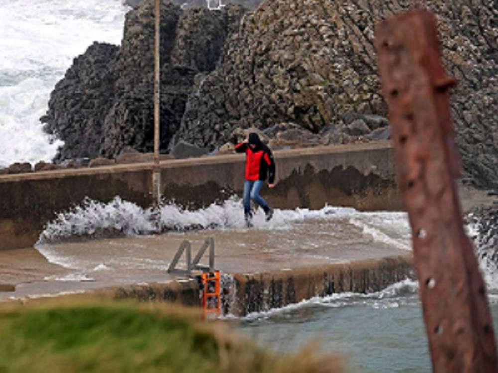
Ballintoy Harbour, Co Antrim as Storm Dudley hit. Pic: Steven McAuley/McAuley Multimedia
 Graffiti in Belfast probed as ‘racially motivated hate crime’
 Man appears in court charged with manslaughter of Carl Holland in Belfast
 DUP reveals details of review into what was known about Donaldson’s conduct
 Police urged to act after replica of mosque placed on top of loyalist bonfire
 Survivors of 1992 UVF gun attack settle civil case
Comments
Add a comment